|
Bucks Geology GroupCollege Lake
Grid reference: SP 940 142.Ordnance Survey map: Aylesbury and Leighton Buzzard Sheet 165.Geological maps: 1:50,000 series Aylesbury sheet 238.Bucks County Council administration area: Aylesbury Vale.Owned by: Castle Cement Ltd run on long-term lease to BBOWT as College Lake Wildlife Centre.Area of site: 65 ha.
Access, location and parking: College Lake is located on the B488 north of Tring near Bulbourne. There is ample parking and a small donation for entrance. Opening Hours 10am to 4pm (Winter) and 10am to 5pm (Summer). Open Tuesday to Sunday, plus Bank Holiday Mondays. Only assistance dogs are permitted. No bicycles or scooters are permitted on the reserve but there are bicycle racks available for those arriving by bicycle. The site is pushchair and wheelchair friendly with two trampers available, which need to be booked in advance (01442 826774).
Interest Summary: College Lake is a very important site for the Quaternary with display areas for the Chalk as well as ice age geology. A BBOWT site and bird watching and other nature activities are very popular.
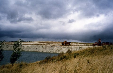
College Lake was once a large Chalk pit, now restored as a nature reserve. The site still holds significant geological interest for the glacial, periglacial and Chalk. In addition, there is the relationship of the underlying rock to the landscape (Chalk escarpment, dip slopes and coombs). The site is already a geological SSSI (at SP 934 145) for Quaternary sediments in channel form as well as excellent periglacial features and a fossil soil of possible Alleroed age.
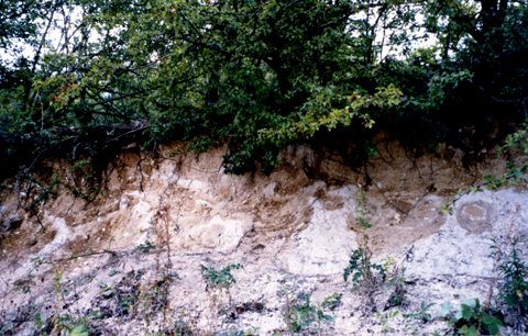
Quaternary Channel fills : River channels are cut into the Chalk and show fossil evidence of temperate conditions. The fossils (from Number 2 channel) were an assemblage of mammalian remains, some of which are displayed in the Geology building. There are a variety of ways to walk round the site, which provides a continuous exposure within the Chiltern dip-slope deposits of Late Pleistocene age. Most of these sediments result from the type of slope processes that occur at the end of a glaciation, especially solifluction. This deposit can be seen in the 2m cut section along the pathway walking to the far north of the site. Periglacial features: the Coombe rock contains much evidence of tundra conditions: cryoturbation (seen as involutions in the upper layers of sediment) and ice wedge casts.
Churning up of the upper layers by frost (cryoturbation)
An ice wedge in the sediments at the top of the quarry, showing this was once a tundra environment undergoing freeze-thaw action The site also offers a rare large exposure of Lower and Middle Chalk in Bucks. The changes in the Chalk from the more clay-rich, grey limestones of the Grey Chalk Subgroup (Lower Chalk, mostly now beneath the water level) to the purer and whiter Middle Chalk with the associated increase in flint development upwards can be demonstrated within the site. The Zig Zag Chalk Formation is currently exposed just above the water line of the large lake. There are loose Sarsen stones on the edges of the site which provide an interesting view of the Tertiary part of our geological history (they will not have been moved far from their original location, probably within the quarried areas). The form of Sarsen stone here is similar to the Denner Hill type from the High Wycombe area and it represents a silcrete - a fossil soil horizon today only forming in places like the Sahara and Australia.
|


