|
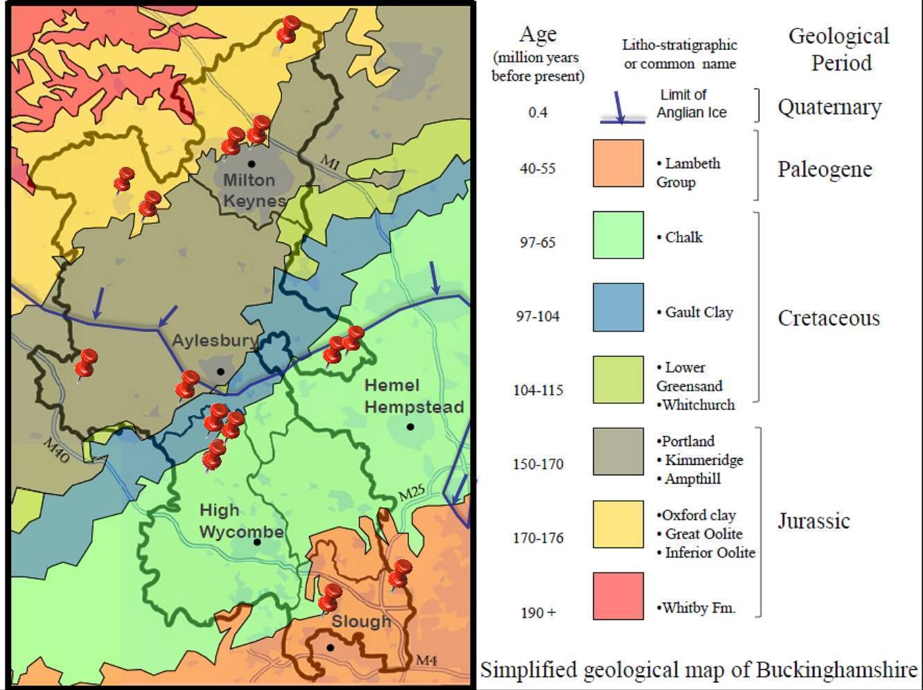
Bucks Geology GroupBuckinghamshire Geology MapThe oldest rocks and fossils cropping out at the surface of Buckinghamshire are 190 million years old. These are strata called Upper Lias, part of the Jurassic sequence of marine rocks underlying the northern part of the county (see Geological Sketch Map, below). The British Isles were much further south 190 million years ago - far enough to be enjoying a tropical climate at around the same latitude as North Africa. Most of the Jurassic rocks seen at the surface of Bucks were deposited in the sea, until just before the end of this period, 145 million years ago. How do geologists know this? The evidence is in the rocks and fossils and this website aims to help you discover what it is, how to interpret it, and to point you to places where you can see it for yourselves.The surface rocks of Buckinghamshire, unlike other parts of the British Isles, are all sedimentary rocks. This means they were laid down as particles that have been weathered and eroded from somewhere else. Sometimes geologists can tell where the 'somewhere else' was, and sometimes it is impossible. But the interesting part of the story for Bucks is - what were the different environments for these sediments? - where has Bucks been in the past? - and where to visit in order to see these rocks and fossils for yourselves.
Geological sketch of the main solid geology of Bucks. Remember, these layers are often blanketed by so-called 'drift' deposits - material left behind when the ice melted (boulder clay), gravels produced by meltwater streams or, for example, wind-blown silt.If you want to know the detailed geology you can always order geological maps from the British Geological Survey ( www.bgs.ac.uk ). You will want the 1:50 000 Geological sheet for one of the following, depending in what area you are interested:Thame, Aylesbury, Henley-on-Thames, Beaconsfield, Buckingham. Leighton Buzzard, Milton Keynes.
|