|
Bucks Geology Group
Brill Hill
Grid reference: SP 650 140.
Ordnance Survey map:
Aylesbury and Leighton Buzzard Sheet 165.
Geological maps:
1:50,000 series Thame sheet 237.
Bucks County Council administration area:
Aylesbury Vale.
Owned by:
Open access areas around the town and windmill.
Area of site: ha.
Interest Summary: The geological interest in the form of local building materials, can be seen in the building stones of the village, which incorporate a large collection of locally sourced stone including Whitchurch Sandstone and Portland Limestone. Geologically, Brill is one of several villages in the area which are situated directly on the Whitchurch Sandstone.
Access, location and parking:
Brill is easy to reach being NW of Thame and south of the A41, off the B4011. Parking in Brill can be limited, especially at peak leisure times. Please park considerately.
Brill is one of a number of outlier hills which are capped by harder more resistive sansdtones and limestones. These include Whitchurch, Stone, Chilton, Waddesdon and Ashendon (see geology sketch below). The hills are only present because of the resistant capping provided by the Whitchurch Sandstone and the of equally hard Portland Stone underlying the Whitchurch Sandstone. Together they produce a hard layer which is resistant to erosion. The underlying clays around these hills have been eroded down to form the lower clay vales which are a distinctive a feature of this part of Buckinghamshire. The geomorphological aspect of this combination of rock type and erosion has produced a highly aesthetic landscape.
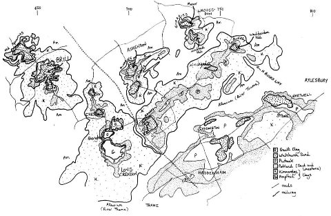
Sketch geology map showing the relationship between the harder Whitchurch and Portland beds and the underlying clays.
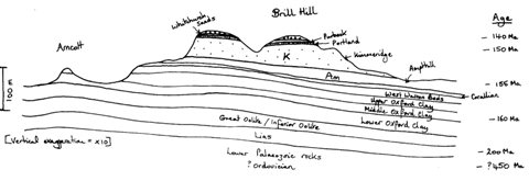
Sketch geology cross-section through Brill Hill.
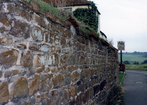
Brill Hill is capped by the Whitchurch Sand Formation dating from the early Cretaceous, 138-131 million years ago. This stratum comprises mainly hard, iron-rich sandstones, used in the construction of many of Brill’s older buildings and walls. Lower, more silty sections include clay beds. At Brill, the Whitchurch Sand has been recorded as up to 18m thick.
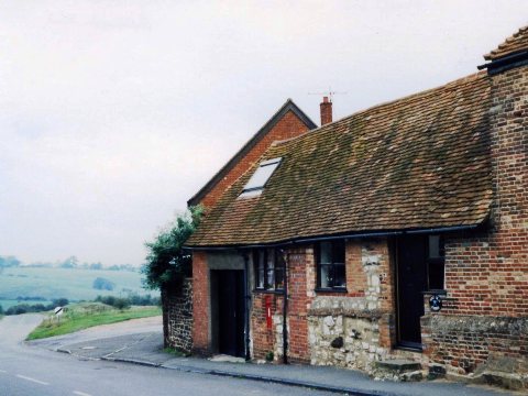
The Whitchurch Sand Formation is underlain by Portland Beds from which Portland Stone, a Jurassic limestone, has been quarried for use in local buildings – note the pale blocks in the building above.
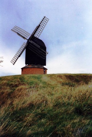
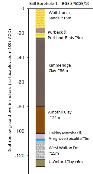
Locally sourced clay from the lower Whitchurch Sand Formation provided the raw material for Brill’s historic brickmaking industry. The extensive extraction of building stone and clay for brickmaking is clearly evidenced by the numerous, large grassed-over pits to be found across the common surrounding the windmill. A near-by borehole (right) drilled in 1986 by the British Geological Survey shows the thickness of the underlying geological beds. Later, the Kimmeridge Clay that surrounds Brill Hill was used for brick making until massive brickworks such as Calvert and Bletchley took over at the end of the 19th Century.
Clay was also responsible for Brill’s most famous export, Brill pottery. Dating from the 13th Century to the mid-1800s. Brill potters produced enormous quantities of distinctive pottery, archaeological evidence for which can be found across Bucks and further afield, especially Oxford. Medieval period, potters accessed clay through numerous shallow pits beneath the ironstones across the hilltop. Examples of Brill Pottery can be seen in the Discover Bucks Museum in Aylesbury.
In the 1830's a fossil tree 12m long was discovered. The account by Thomas Knight in the Provincial Medical Journal- August 1842, gives the account 'On the top of Brill Hill, thick beds of a bright yellow of ochre also exist. On removing a thick bed of it a short time ago, a fine trunk of a fossil tree was exposed, and laid bare the whole length of the pit; its surface was completely covered with metal firmly attached, and though for a time it retained its silvery appearance hardness, till oxygen of the air in a few weeks its frail nature, and resolved it into green crystals of sulphate of iron. The bed of green sand underneath this cuiriosity had great quantities of pyritic formations, in the shape of irregular balls weighing several ounces.'
|


